We are able to fly within the current FAA/AMA UAV and GA parameters including: Filed flight plans NOTAMs and COAs, line of sight, dedicated spotter, under 55lbs, under 400’ max ceiling (UAV missions) and minimum 500’ to a usable max ceiling of approximately 5,000’ (GA missions). Maximum wind for UAV is up to 30mph depending on platform. Safety is our primary mission, all flights have a dedicated safety officer. All equipment have dual points of redundancy and GPS failsafe (return to land). All on board flight equipment is bench tested and certified before being attached to the airframe. Each airframe (sUAV) is inspected prior to each mission and data loggers checked with the mission planning interface for GPS lock and safe return to land. Each flight and vehicle update are reported to their individual flight status log. Each UAV and the business are fully insured and bound per project starting at two million dollars and can expanded to accommodate any needs from the client.
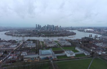
UAV missions are flown within Visual Line of Sight (VLOS) with guidance from client on site, interactively with our ground stations. Additionally missions can be programed from Google Earth, mapped, data collected and flown exactly the same path as many times as needed. Very useful tools for progressive and archival as built aerial footage across many different disciplines.
GA missions are flown within FAA guidelines with approved payloads for data collection.
Before, during and after construction documentation can be added to your project. From a one time overall images/videos to be added to your portfolio, to interval shots / time lapse showing progress of your project. We can help professionally capture your project from perspectives that were cost prohibitive in the past. All post production work is completed in house, from a simple cut and splice for just the air time and removing all sound, to full broadcast quality video for company sales presentations and video brochures.